LANDSCAPES AND RURAL AREAS – TRANSITION IN RURAL AREAS
WHAT DOES STEENHUISMEURS DO?
Since 2023, SteenhuisMeurs has been developing landscape biographies of so-called transition areas in the countryside. These agricultural areas are situated near Natura 2000 zones. Various challenges converge: regional water management, nitrogen reduction, future-proof agriculture, conservation of nature and climate adaptation. This complex endeavour confronts every province in the Netherlands. Uncertainty, concern, and at times, even resentment among farmers and residents prevail, as this transition involves high stakes ánd multiple projections onto our landscape.
The current provincial strategies are very similar: what applies to one area also applies to another. The question is whether this is a valid assumption. SteenhuisMeurs combines archival research with fieldwork and numerous conversations with local inhabitants. This approach yields an analysis of the landscape and land use and provides valuable insights into the values and beliefs of these agricultural communities. To navigate these intricate dynamics, it is so important to understand the layer of values and convictions. In every area, they are different. The approach developed by SteenhuisMeurs is built on an understanding of both the area ánd its community. It provides relief from tension and more space in often arduous operations. The motto is: from a region-focussed to a region-specific approach.
CASE 1
LIVING AND WORKING IN HAARLE
Landscape biography
commisioned by the Noaberschap Haarle
SteenhuisMeurs carried out cultural heritage research as part of preparations for future plans for Haarle. This was part of a broader regional process. The study focused on Haarle’s history and the essence of noaberschap (a deeply ingrained pattern of local community ties), examining who the people are that form the community and how their history has influenced spatial development. Interviews with multiple generations provided valuable insights into local mentality and community dynamics. Based on this, SteenhuisMeurs defined the core values and dynamics of the area. The research resulted in recommendations for development guided by the central question: how can an area and community change without losing its identity?
The results were presented by Marinke and are available here (in Dutch).

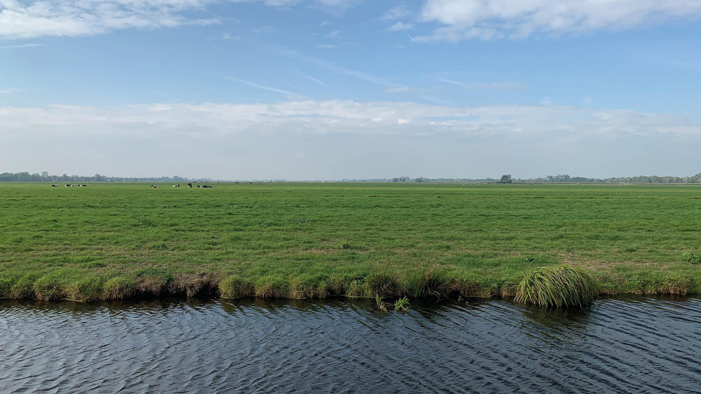
The countryside of Haarle
CASE 2
OUDDORP, CROWN JEWEL OF SOUTH HOLLAND
Cultural heritage analysis and guide for developments
commissioned by the Province of South Holland and Municipality of Goeree-Overflakkee
The unique landscape of ‘zandwallen’ and ‘schurvelingen’ at Ouddorp has been designated one of the ‘crown jewels’ of South Holland. It holds major cultural heritage value for both the province and the town. The goal is to preserve these qualities without halting development. SteenhuisMeurs was asked to prepare a guide for integrating spatial initiatives within this crown jewel.
The research had two components. The first part was the story of Ouddorp. Tracing the centuries-long influence of soil and sea on life, and the planning policies of the past 80 years. This showed how Ouddorp evolved from an independent island to a village landscape where many spatial claims converge: housing, recreation, farming, nature, and business. Local stories were gathered through interviews with residents and professionals. This narrative is also available as a video (in Dutch).
The second part provides insight in the heritage values and guidelines for new developments. The document maps significant places, vistas, and ensembles, and illustrating the landscape’s capacity for change. This guide builds on provincial policy and aligns with the municipal zoning plan.

A typical linear sand mount in Ouddorp
CASE 3
THE GENERATIONS OF GEUS (GARDEREN, ELSPEET, UDDEL, SPEULD): VALUED SOIL
Landscape biography
commissioned by Gebiedsaanpak GEUS
In the Gelderland Gebiedsaanpak GEUS, cultural history is referred to as the foundation. SteenhuisMeurs conducted an in-depth analysis of cultural history, mentality and the relationship between government and citizens. For centuries, the GEUS area has been cultivated by small farmers, who endured a challenging existence prior to the introduction of artificial fertilisers. Yet, it was also an existence in which the communal ‘marke’-organisations as well as religion fostered a strong sense of community. What has been the impact of the sale of communal lands, spurred by the rise of tourism and post-war village expansions? How did the scarcity of agricultural land lead to the emergence of calf-rearing farms? This area has its own traditions, norms and values, with religion serving as the foundation for many lives. Watch the filmed account of this story (only in Dutch): gebiedsaanpakgeus.nl

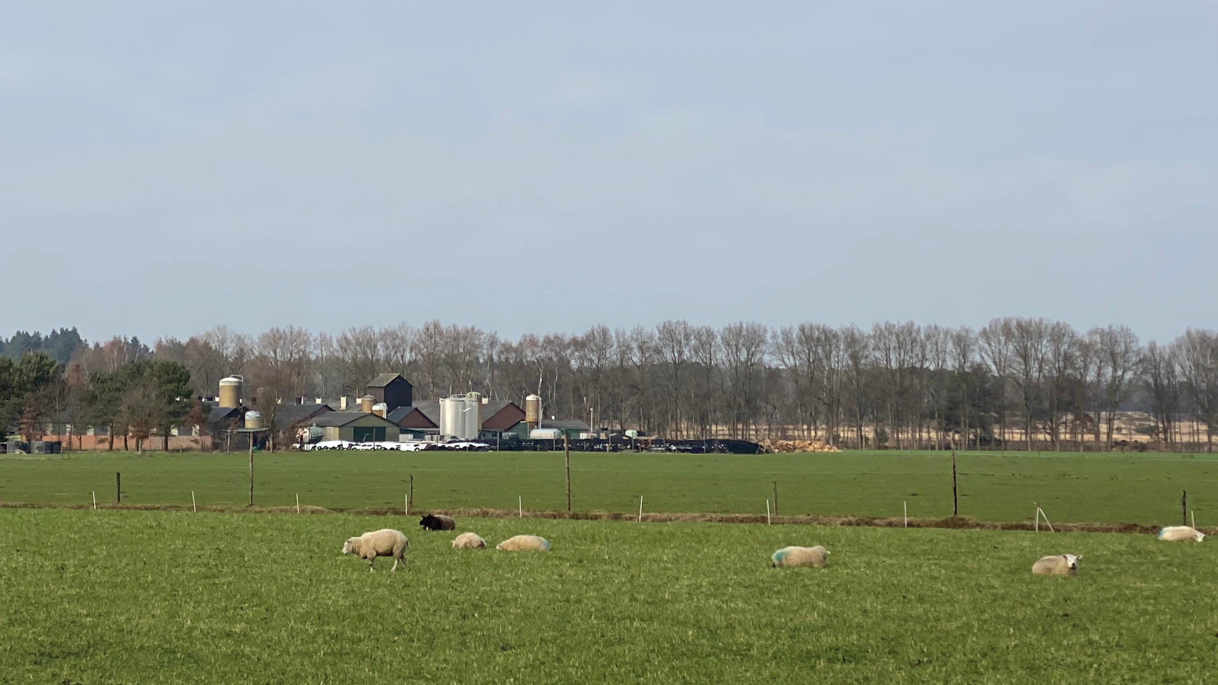
Hezingen, Mander, Manderveen
CASE 4
HEZINGEN, MANDER, MANDERVEEN: THE SOIL, THE PEOPLE AND THE LANDSCAPE THROUGHOUT THE CENTURIES
Landscape biography
commisioned by the province of Overijssel
It is a well-known systemic law: ‘Where there is resistance, loyalty to something else applies’. In the area of Springendal/Dal van de Mosbeek, SteenhuisMeurs delved into the beliefs and guiding principles of this agricultural community. Which patterns of land cultivation and collectivity could aid in the complex transition that this area is facing? Beneath modern interventions, the old laws and customs of ancestors often persist in local communities. These qualities make communities unique and seemingly peculiar to outsiders, who may be startled by certain actions that are, however, quite natural for the community itself. This project consisted of an exploration of the cultural-historical and agricultural development and provided lessons that were derived from it. Watch the film recording of this story (only in Dutch): youtube.com

Map of species in 1955-1965, Staverden and surroundings
LANDSCAPES AND RURAL AREAS – TRANSITION IN RURAL AREAS
WHAT DOES STEENHUISMEURS DO?
Since 2023, SteenhuisMeurs has been developing landscape biographies of so-called transition areas in the countryside. These agricultural areas are situated near Natura 2000 zones. Various challenges converge: regional water management, nitrogen reduction, future-proof agriculture, conservation of nature and climate adaptation. This complex endeavour confronts every province in the Netherlands. Uncertainty, concern, and at times, even resentment among farmers and residents prevail, as this transition involves high stakes ánd multiple projections onto our landscape.
The current provincial strategies are very similar: what applies to one area also applies to another. The question is whether this is a valid assumption. SteenhuisMeurs combines archival research with fieldwork and numerous conversations with local inhabitants. This approach yields an analysis of the landscape and land use and provides valuable insights into the values and beliefs of these agricultural communities. To navigate these intricate dynamics, it is so important to understand the layer of values and convictions. In every area, they are different. The approach developed by SteenhuisMeurs is built on an understanding of both the area ánd its community. It provides relief from tension and more space in often arduous operations. The motto is: from a region-focussed to a region-specific approach.
CASE 1
LIVING AND WORKING IN HAARLE
Landscape biography
commisioned by the Noaberschap Haarle
SteenhuisMeurs carried out cultural heritage research as part of preparations for future plans for Haarle. This was part of a broader regional process. The study focused on Haarle’s history and the essence of noaberschap (a deeply ingrained pattern of local community ties), examining who the people are that form the community and how their history has influenced spatial development. Interviews with multiple generations provided valuable insights into local mentality and community dynamics. Based on this, SteenhuisMeurs defined the core values and dynamics of the area. The research resulted in recommendations for development guided by the central question: how can an area and community change without losing its identity?
The results were presented by Marinke and are available here (in Dutch).
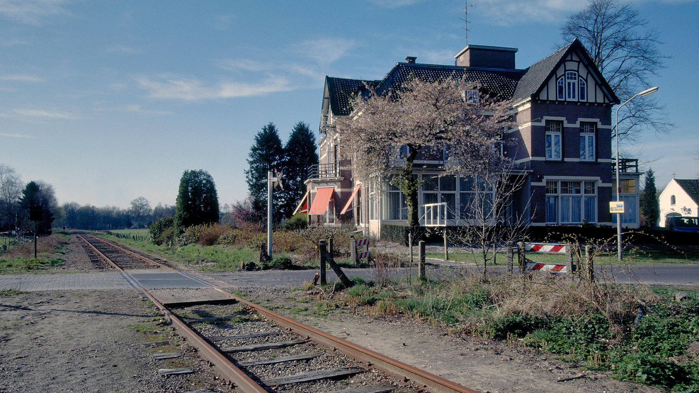
The countryside of Haarle
CASE 2
OUDDORP, CROWN JEWEL OF SOUTH HOLLAND
Cultural heritage analysis and guide for developments
commissioned by the Province of South Holland and Municipality of Goeree-Overflakkee
The unique landscape of ‘zandwallen’ and ‘schurvelingen’ at Ouddorp has been designated one of the ‘crown jewels’ of South Holland. It holds major cultural heritage value for both the province and the town. The goal is to preserve these qualities without halting development. SteenhuisMeurs was asked to prepare a guide for integrating spatial initiatives within this crown jewel.
The research had two components. The first part was the story of Ouddorp. Tracing the centuries-long influence of soil and sea on life, and the planning policies of the past 80 years. This showed how Ouddorp evolved from an independent island to a village landscape where many spatial claims converge: housing, recreation, farming, nature, and business. Local stories were gathered through interviews with residents and professionals. This narrative is also available as a video (in Dutch).
The second part provides insight in the heritage values and guidelines for new developments. The document maps significant places, vistas, and ensembles, and illustrating the landscape’s capacity for change. This guide builds on provincial policy and aligns with the municipal zoning plan.
A typical linear sand mount in Ouddorp
CASE 3
THE GENERATIONS OF GEUS (GARDEREN, ELSPEET, UDDEL, SPEULD): VALUED SOIL
Landscape biography
commissioned by Gebiedsaanpak GEUS
In the Gelderland Gebiedsaanpak GEUS, cultural history is referred to as the foundation. SteenhuisMeurs conducted an in-depth analysis of cultural history, mentality and the relationship between government and citizens. For centuries, the GEUS area has been cultivated by small farmers, who endured a challenging existence prior to the introduction of artificial fertilisers. Yet, it was also an existence in which the communal ‘marke’-organisations as well as religion fostered a strong sense of community. What has been the impact of the sale of communal lands, spurred by the rise of tourism and post-war village expansions? How did the scarcity of agricultural land lead to the emergence of calf-rearing farms? This area has its own traditions, norms and values, with religion serving as the foundation for many lives. Watch the filmed account of this story (only in Dutch): gebiedsaanpakgeus.nl
Hezingen, Mander, Manderveen
CASE 4
HEZINGEN, MANDER, MANDERVEEN: THE SOIL, THE PEOPLE AND THE LANDSCAPE THROUGHOUT THE CENTURIES
Landscape biography
commisioned by the province of Overijssel
It is a well-known systemic law: ‘Where there is resistance, loyalty to something else applies’. In the area of Springendal/Dal van de Mosbeek, SteenhuisMeurs delved into the beliefs and guiding principles of this agricultural community. Which patterns of land cultivation and collectivity could aid in the complex transition that this area is facing? Beneath modern interventions, the old laws and customs of ancestors often persist in local communities. These qualities make communities unique and seemingly peculiar to outsiders, who may be startled by certain actions that are, however, quite natural for the community itself. This project consisted of an exploration of the cultural-historical and agricultural development and provided lessons that were derived from it. Watch the film recording of this story (only in Dutch): youtube.com